TIFF
Type of resources
Available actions
Topics
Keywords
Contact for the resource
Provided by
Years
Formats
Representation types
Update frequencies
Scale
Resolution
-
Potential cumulative impacts on benthic habitats is based on the same method than http://metadata.helcom.fi/geonetwork/srv/eng/catalog.search#/metadata/9477be37-94a9-4201-824a-f079bc27d097, but is focused on physical pressures and benthic habitats. The dataset was created based on separate analysis for potential cumulative impacts on only the benthic habitats, as these are particularly affected by physical pressures. In this case the evaluation was based on pressure layers representing http://metadata.helcom.fi/geonetwork/srv/eng/catalog.search#/metadata/ea0ef0fa-0517-40a9-866a-ce22b8948c88 and http://metadata.helcom.fi/geonetwork/srv/eng/catalog.search#/metadata/05e325f3-bc30-44a0-8f0b-995464011c82, combined with information on the distribution of eight broad benthic habitat types and five habitat-forming species (http://metadata.helcom.fi/geonetwork/srv/eng/catalog.search#/metadata/363cb353-46da-43f4-9906-7324738fe2c3, http://metadata.helcom.fi/geonetwork/srv/eng/catalog.search#/metadata/f9cc7b2c-4080-4b19-8c38-cac87955cb91, http://metadata.helcom.fi/geonetwork/srv/eng/catalog.search#/metadata/264ed572-403c-43bd-9707-345de8b9503c, http://metadata.helcom.fi/geonetwork/srv/eng/catalog.search#/metadata/822ddece-d96a-4036-9ad8-c4b599776eca and http://metadata.helcom.fi/geonetwork/srv/eng/catalog.search#/metadata/ca327bb1-d3cb-46c2-8316-f5f62f889090). The potential cumulative impacts has been estimated based on currently best available data, but spatial and temporal gaps may occur in underlying datasets. Please scroll down to "Lineage" and visit http://stateofthebalticsea.helcom.fi/cumulative-impacts/ for more info.
-
The Baltic Sea Impact Index is an assessment component that describes the potential cumulative burden on the environment in different parts of the Baltic Sea. The BSII is based on georeferenced datasets of human activities (36 datasets), pressures (18 datasets) and ecosystem components (36 datasets), and on sensitivity estimates of ecosystem components (so-called sensitivity scores) that combine the pressure and ecosystem component layers, created in <a href="http://www.helcom.fi/helcom-at-work/projects/holas-ii" target="_blank">HOLAS II</a> project. Cumulative impacts are calculated for each assessment unit (1 km2 grid cells) by summing all pressures occurring in the unit for each ecosystem component. Highest impacts are found from the cells where both are abundant, but high impacts can be caused also by a single pressure if there are diverse and sensitive habitats in the grid cell. All data sets and methodologies used in the index calculations are approved by all HELCOM Contracting Parties in review and acceptance processes. This data set covers the time period 2011-2016. Please scroll down to "Lineage" and visit <a href="http://stateofthebalticsea.helcom.fi/cumulative-impacts/" target="_blank">State of the Baltic Sea website</a> for more info.
-
The Baltic Sea Pressure Index is a calculation of quantity and spatial distribution of potential cumulative impacts on the Baltic Sea. The BSII is based on georeferenced datasets of human activities (36 datasets), pressures (18 datasets) and ecosystem components (36 datasets), and on sensitivity estimates of ecosystem components (so-called sensitivity scores) that combine the pressure and ecosystem component layers, created in <a href="http://www.helcom.fi/helcom-at-work/projects/holas-ii" target="_blank">HOLAS II</a> project. The assessment can be applied with a focus on pressures only by using the Baltic Sea Pressure Index (BSPI) which shows the anthropogenic pressures/human activities in the defined assessment units without including ecosystem components. The BSPI however includes a weighting component in order to grade the effect of the pressures on the ecosystem in a generalized perspective. Cumulative impacts are calculated for each assessment unit (1 km2 grid cells) by summing all impacts occurring in the unit. All datasets and methodologies used in the index calculations are approved by all HELCOM Contracting Parties in review and acceptance processes. This dataset covers the time period 2011-2016. Please scroll down to "Lineage" and visit <a href="http://stateofthebalticsea.helcom.fi/cumulative-impacts/" target="_blank">State of the Baltic Sea website</a> for more info.
-
Pinnanmuotoja kuvaava korkeusmalli Varsinais-Suomen alueelta. Aineisto on tuotettu Turun yliopiston maantieteenlaitoksella. Aineisto vaihtuu tarkempaan mittakaavassa 1:250 000. Aineisto soveltuu karttapalvelukäyttöön. Aineisto on katsottavissa Lounaistiedon karttapalvelusta https://karttapalvelu.lounaistieto.fi/
-

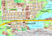
Opaskartta on yleistetty karttatuote, jonka ylläpitomittakaava on 1:10000. Opaskartat kattavat Mänttä-Vilppulan kaupungin alueen: Mäntän, Vilppulan ja Kolhon taajamista on tarkempi karttatuote. Sisätää tiet (nimet ja osoitenumeroita), vesistöt, rakennetut alueet ja julkiset palvelut. Saatavana painettuna ja sähköisissä muodoissa. Päivitys ja ylläpito jatkuvaa.
-

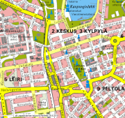
Opaskartta on yleistetty karttatuote, jonka ylläpitomittakaava on 1:15 000. Opaskartta kattaa koko Lappeenrannan kaupungin alueen sekä lisäksi osia naapurikuntien alueista. Aineisto sisältää mm. seuraavia kohteita: nimistö, kadut, tiet ja rautatieyhteydet, julkisia rakennuksia, asuinalueet, teollisuusalueet, puisto-, metsä-, pelto- ja vesistöalueet sekä kunnan- ja valtakunnanrajat. Aineistoa ylläpidetään jatkuvasti.
-

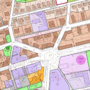
Lappeenrannan ajantasa-asemakaava on yhdistelmä hyväksytyistä ja lainvoiman saaneista asemakaavoista. Aineistoa ylläpidetään jatkuvasti vektorimuodossa.
-
Lappeenrannan kaupungin alueen yleiskaavojen yhdistelmä. Aineistoa ylläpidetään vektorimuodossa tietokannassa kaavojen valmistumisen mukaan.
-

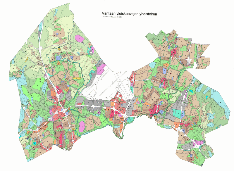
Voimassa olevien yleiskaavojen yhdistelmä. Esitysmuoto: rasteri. Yleiskaava on yleispiirteinen suunnitelma, jolla ohjataan kaupungin yhdyskuntarakennetta, maankäyttöä ja liikenneverkkoa. Siinä varataan alueita mm. asumisen, työpaikkojen, liikenteen, luonnonsuojelun ja virkistyksen tarpeisiin. Yleiskaava esitetään kartalla, ja siihen kuuluvat lisäksi kaavamerkinnät ja -määräykset sekä kaavaselostus. Tyypillisiä yleiskaavassa ratkaistavia asioita ovat mm. uudet pääliikenneväylät, kaupungin laajenemissuunnat ja erityistoimintojen kuten varikkojen, jätteenkäsittelylaitosten ja vastaavien ympäristöhäiriötä aiheuttavien toimintojen sijoittuminen. Pääosalla Vantaata on voimassa kaupunginvaltuuston 17.12.2007 hyväksymä yleiskaava 2007, joka on tullut voimaan kuulutuksin 25.2.2009, 3.6.2009 ja 13.1.2010. Osalla Länsi-Vantaata on voimassa kaupunginvaltuuston 19.6.2006 hyväksymä Marja-Vantaan osayleiskaava, joka tuli voimaan 9.7.2008. Pienellä osalla Hakkilaa ja Jokiniemeä on voimassa kaupunginvaltuuston 14.9.1992 hyväksymä Vantaan yleiskaava 1992.
 DEMO Paikkatietohakemisto