 DEMO Paikkatietohakemisto
5000
Type of resources
Available actions
Topics
Keywords
Contact for the resource
Provided by
Years
Formats
Representation types
Update frequencies
Scale
Resolution
-

The location of the real property unit is shown on the cadastral index map. On the map, there are property and other register unit boundaries, boundary markers and property identifiers. The Land Information System of Finland contains attribute data related to property. Further information (in Finnish): http://www.maanmittauslaitos.fi/kiinteistot/asiantuntevalle-kayttajalle/kiinteistotiedot-ja-niiden-hankinta The product belongs to the open data of the National Land Survey of Finland. More information: Topographic data and how to acquire it: http://www.maanmittauslaitos.fi/en/maps-and-spatial-data/expert-users/topographic-data-and-how-acquire-it
-
-

The Background map series is a dataset product series in raster format that depicts the whole of Finland and that is meant for web use as a background material for thematic data. Its key objects are road names, roads and railways, buildings and constructions, administrative borders, geographical names, waterways, land use and addresses of buildings (from the Population Register Centre). The product belongs to the open data of the National Land Survey of Finland. More information: Topographic data and how to acquire it http://www.maanmittauslaitos.fi/en/maps-and-spatial-data/expert-users/topographic-data-and-how-acquire-it.
-

-
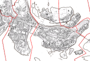
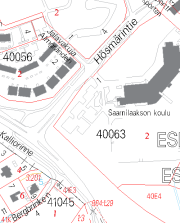
Virastokartta on asemakaavan pohjakartasta johdettu maastokartta, joka on laadittu 1:5 000 mittakaavaan ja sille määriteltyjä kuvausteknisiä ohjeita noudattaen. Karttaa pidetään jatkuvasti ajan tasalla, tietosisältönä on asemakaava-alueiden kiinteistöjaotus ja tonttien osoitenumerot. Lisäksi kartalla esitetään yleistetysti maankäyttöä. Aineisto on saatavissa WMS-palveluna.
-
Aineisto sisältää oikeusvaikutteiset ranta-osayleiskaavat ajantasakaava-muodossa ja keskustaajaman oikeusvaikutuksettoman osayleiskaavan rajauksen. Aineisto on tuotettu digitoimalla ArcGis-ohjelmalla. Aineistoa päivitetään mahdollisten kaavamuutosten mukaan.
-
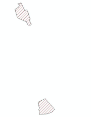
Sisältää Oriveden kaupungin rakennuskieltoalueet Aineisto on tuotettu digitoimalla ArcGis-ohjelmalla. Aineistoa päivitetään rakennuskieltopäätösten mukaisesti.
-
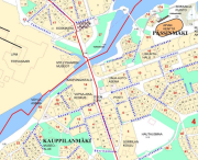
Espoon kaupungin ylläpitämä osoitekartta. Viiva-aineisto johdetaan kantakartalta, tekstit ylläpidetään tätä tuotetta varten. Saatavissa WMS- ja WFS-palveluiden kautta.
-
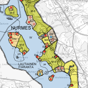
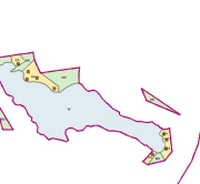
Oikeusvaikutteiset Nurmeksen rantaosayleiskaavat osoittavat rantojen käyttötarkoituksen. Aineisto sisältää Pielisten Kuokkastenjärven rantaosayleiskaavan sekä edellisen muutokset (Haapolahti, Karsikkoniemi, Nurmesniemi I, Suusaari, Tetriniemi ja Revonniemi) sekä Nurmeksen keskustaajaman rantaosayleiskaavan (Länsiranta, Itäranta, Vinkerranta). Osayleiskaavojen sijainnit on esitetty erillisissä indeksikartoissa. Yleiskaavassa esitetään tavoitellun kehityksen periaatteet ja osoitetaan tarpeelliset alueet yksityiskohtaisen kaavoituksen ja muun suunnittelun sekä rakentamisen ja muun maankäytön perustaksi. Aineisto on pääosin rasterimuodossa, uusimpien kaavojen osalta myös vektorimuodossa (AutoCAD/dwg). Kaavat ovat ladattavissa pdf-muodossa Lieksan ja Nurmeksen teknisen viraston verkkosivuilta. Nurmeksen kaupungin käyttämä aineistojen koordinaattijärjestelmä on EUREF-FIN (ETRS-GK29) ja korkeusjärjestelmä N2000. Aineistoa päivitetään mahdollisten kaavamuutosten mukaan.