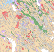
 DEMO Paikkatietohakemisto
dataset
Type of resources
Available actions
Topics
Keywords
Contact for the resource
Provided by
Years
Formats
Representation types
Update frequencies
status
Service types
Scale
Resolution
-
An aerial photograph is a photograph of the terrain taken from an aeroplane. The images are vertical photographs applicable to be used in mapping. The aerial photographs are reprocessed into dimensionally accurate images called orthophotos. Aerial photographs are available since the 1930s, depending on the area. Aerial photographs are available in black and white, colour and infrared. The size and accuracy of aerial photos depend on the camera, photography scale and altitude or ground sample distance (GSD). The product belongs to the open data of the National Land Survey of Finland. More information: Topographic data and how to acquire it http://www.maanmittauslaitos.fi/en/maps-and-spatial-data/expert-users/topographic-data-and-how-acquire-it
-
The EMODnet (European Marine Observation and Data network) Geology project (http://www.emodnet-geology.eu/) collects and harmonizes marine geological data from the European sea areas to support decisionmaking and sustainable marine spatial planning. The partnership includes 39 marine organizations from 30 countries. The partners, mainly from the marine departments of the geological surveys of Europe (through the Association of European Geological Surveys- EuroGeoSurveys), have assembled marine geological information at a scale of 1:50 000 from all European sea areas (e.g. the White Sea, Baltic Sea, Barents Sea, the Iberian Coast, and the Mediterranean Sea within EU waters). This data includes the EMODnet seabed substrate map at a scale of 1: 50 000 from the European marine areas. Traditionally, European countries have conducted their marine geological surveys according to their own national standards and classified substrates on the grounds of their national classification schemes. These national classifications are harmonized into a shared EMODnet schema using Folk's sediment triangle with a hierarchy of 16, 7 and 5 substrate classes. The data describes the seabed substrate from the uppermost 30 cm of the sediment column. The smallest cartographic unit within the data is about 0.01 km2. Further information about the EMODnet-Geology project is available on the portal (http://www.emodnet-geology.eu/).
-
Seabed substrate 1:100 000 is one of the products produced in the EMODnet (European Marine Observation and Data network) Geology III EU project. Project provided seabed geological material from the European maritime areas. The EMODnet Geology III project (http://www.emodnet-geology.eu/) collects and harmonizes geological data from the European sea areas to support decision-making and sustainable marine spatial planning. The EMODnet Geology partnership has included 39 marine organizations from 30 countries. This data includes the EMODnet seabed substrate map at a scale of 1:100 000 from the Finnish marine areas. It is based on the data produced on a scale of 1:20 000 by the Geological Survey of Finland (GTK). The data has been harmonized and reclassified into five Folk substrate classes (clay + silt (mud), sandy clays, clayey sands, coarse sediments, mixed sediments) and bedrock. The data describes the seabed substrate from the uppermost 30 cm of the sediment column. The data have been generalized into a target scale (1:100 000). The smallest smallest cartographic unit within the data is 0.05 km2 (5 hectares). Further information about the EMODnet-Geology project III is available on the portal (http://www.emodnet-geology.eu/). Permission (AN17367) to publish the material was obtained from the Finnish Defence Office 29.9.2017.
-
The GML file products containing geographic names comprise of place name products and map name products. The place name products include data about approximately 800,000 named places and their names in different languages. Data about place are among others place type, plane location and height above sea level, and data about names are among others the spelling that has been checked by the Institute for the Languages of Finland and language (Finnish, Swedish, Northern Sami, Inari Sami or Skolt Sami. In the place name products, every place and its name or names appear only once. The map name products contain the place names that have been selected for the National Land Survey's nine standard map products and information about the cartographical presentation of them. The information includes the location of the name on the map, for instance the coordinates of the left lower corner of the map text, the direction and bending of the text as well as typographical information, such as font type, size and colour. The name of a particular place, such as a river, can appear several times in the same map product. The file products containing geographic names are GML files whose contents are equivalent to the interface products in the Geographic names search service (WFS). One file always contains the data about the entire country. There are two place name products (Places and Place names), nine map name products, one for each map product (map scale). The geographic names products are available for downloading on the National Land Survey's File service of open data https://tiedostopalvelu.maanmittauslaitos.fi/tp/kartta/?lang=en
-

Lack of spatial soil data in digital form has been a primary obstacle in establishing European policies on land use and environmental protection. Abundant data on soil characteristics exist in Finland but have been scattered among various sources, making it difficult for authorities to make country-wide presentations and predictions.The objective of the project was to create georeferenced soil map and database according to the instructions of the European Soil Bureau using data from existing databases and collecting some new data. The basis of the work was a geological map of quaternary deposits, which describes the soil at a depth of 1 metrem (parent material) according to the Finnish classification based on the concentration of organic matter and the texture of mineral material. Primary research topics included generalization methodology of soil polygons with GIS technology, calculation of soil characteristics needed in the database and computerizing the existing non-digital soil information. It was proved that aerial geophysics can be used for separation of shallow peats from deep peat soils and muddy soils and other wet areas can be identified. Soil names according to the FAO/Unesco system and the World Reference Base for Soil Resources (WRB-2014) were derived from the soil names of the Finnish soil classification system and geophysical data. Soilscape (Soil Mapping Units) of Finland with WRB-2014 soil classification, intented to be used in European scale e.g to delineate risk areas mentioned in soil framework directive proposal.
-
The Superficial deposits of Finland 1:200 000 (sediment polygons) contains data produced from the whole of Finland during the period 2002-2009. The data set can be used in regional planning, in military defence, in soil mapping (EU) and in joint mapping projects in various areas. The mapping scale has been 1:50 000-1:200 000. In compiling the medium-scale data set, generalised 1:20 000, 1:50 000 and 1:100 000 superficial deposits maps have been used and a new map product at a scale of 1:200 000 that is based on interpretation and field mapping. The minimum size of the sediment polygons is about six hectares. Exceptions are glaciofluvial, marginal till and hummocky moraine deposits, which are presented in the data set as areas with a surface area greater than two hectares. The blanketing peat overburden has been described in the new map product as a peat-covered area (0-0.3 m of peat), thin peat (0.3-0.6 m of peat) and thick peat (over 0.6 m of peat). Peat-covered areas, stone fields and uncovered bedrock areas have been added to the new production map by generalising the corresponding polygons in the terrain database of the National Land Survey of Finland (NLS). In connection with the generation of new production map, field observations have been gathered on the overburden thickness and the stratigraphic sequence at a depth of one metre as well as on rock exposures. Coordinate reference system of the Superficial deposits of Finland 1:200 000 (sediment polygons) was transformed in March 2013. The transformation from Finnish National Grid Coordinate System (Kartastokoordinaattijärjestelmä, KKJ) Uniform Coordinate Frame to ETRS-TM35FIN projection was done by using the three-dimensional transformation in accordance with the recommendations for the public administration JHS154.
-
The EMODnet (European Marine Observation and Data network) Geology project (http://www.emodnet-geology.eu/) collects and harmonizes marine geological data from the European sea areas to support decisionmaking and sustainable marine spatial planning. The partnership includes 39 marine organizations from 30 countries. The partners, mainly from the marine departments of the geological surveys of Europe (through the Association of European Geological Surveys- EuroGeoSurveys), have assembled marine geological information at a scale of 1:100 000 from all European sea areas (e.g. the White Sea, Baltic Sea, Barents Sea, the Iberian Coast, and the Mediterranean Sea within EU waters). This data includes the EMODnet seabed substrate map at a scale of 1:100 000 from the European marine areas. Traditionally, European countries have conducted their marine geological surveys according to their own national standards and classified substrates on the grounds of their national classification schemes. These national classifications are harmonized into a shared EMODnet schema using Folk's sediment triangle with a hierarchy of 16, 7 and 5 substrate classes. The data describes the seabed substrate from the uppermost 30 cm of the sediment column. The data has been generalized into a target scale (1:100 000). The smallest cartographic unit within the data is 0.05 km2 (5 hectares). Further information about the EMODnet-Geology project is available on the portal (http://www.emodnet-geology.eu/).
-
The technical harvesting potential of small-diameter trees can be defined as the maximum potential procurement volume of small-diameter trees available from the Finnish forests based on the prevailing guidelines for harvesting of energy wood. The potentials of small-diameter trees from early thinnings have been calculated for fifteen NUTS3-based Finnish regions covering the whole country (Koljonen et al. 2017). To begin with the estimation of the region-level potentials, technical harvesting potentials were estimated using the sample plots of the eleventh national forest inventory (NFI11) measured in the years 2009–2013. First, a large number of sound and sustainable management schedules for five consecutive ten-year periods were simulated for each sample plot using a large-scale Finnish forest planning system known as MELA (Siitonen et al. 1996; Redsven et al. 2013). MELA simulations consisted of natural processes and human actions. The ingrowth, growth, and mortality of trees were predicted based on a set of distance-independent tree-level statistical models (e.g. Hynynen et al. 2002) included in MELA and the simulation of the stand (sample plot)-level management actions was based on the current Finnish silvicultural guidelines (Äijälä et al. 2014) and the guidelines for harvesting of energy wood (Koistinen et al. 2016). Simulated management actions for the small-tree fraction consisted of thinnings that fulfilled the following stand criteria: • mean diameter at breast height ≥ 8 cm • number of stems ≥ 1500 ha-1 • mean height < 10.5 m (in Lapland) or mean height < 12.5 m (elsewhere). Energy wood was harvested as delimbed (i.e. including the stem only) in spruce-dominated stands and peatlands and as whole trees (i.e. including stem and branches) elsewhere. When harvested as whole trees, a total of 30% of the original crown biomass was left onsite (Koistinen et al. 2016). Energy wood thinnings could be integrated with roundwood logging or carried out independently. Second, the technical energy wood potential of small trees was operationalized in MELA by maximizing the removal of thinnings in the first period. In this way, it was possible to pick out all small tree fellings simulated in the first period despite, for example, the profitability of the operation. However, a single logging event was rejected if the energy wood removal was lower than 25 m³ha-1 or the industrial roundwood removal of pine, spruce, or birch exceeded 45 m³ha-1. The potential calculated in this way contained also timber suitable for industrial roundwood. Therefore, two estimates are given: • potential of trees below 10.5 cm in breast-height diameter • potential of trees below 14.5 cm in breast-height diameter. Subsequently, the region-level potentials were spread on a raster grid at 1 km × 1 km resolution. Only grid cells on Forests Available for Wood Supply (FAWS) were considered in this operation. In this study, FAWS was defined as follows: First, forest land was extracted from the Finnish Multi-Source National Forest Inventory (MS-NFI) 2013 data (Mäkisara et al. 2016). Second, restricted areas were excluded from forest land. The restricted areas consisted of nationally protected areas (e.g. nature parks, national parks, protection programme areas) and areas protected by the State Forest Enterprise. In addition, some areas in northernmost Lapland restricted by separate agreements between the State Forest Enterprise and stakeholders were left out from the final data. Furthermore, for small trees, FAWS was further constrained by the stand criteria presented above to represent similar stand conditions for small-tree harvesting as in MELA. Finally, the region-level potentials were distributed to the grid cells by weighting with MS-NFI stem wood biomasses. References Äijälä O, Koistinen A, Sved J, Vanhatalo K, Väisänen P (2014) Metsänhoidon suositukset [Guidelines for sustainable forest management]. Metsätalouden kehittämiskeskus Tapion julkaisuja. Hynynen J, Ojansuu R, Hökkä H, Salminen H, Siipilehto J, Haapala P (2002) Models for predicting the stand development – description of biological processes in MELA system. The Finnish Forest Research Institute Research Papers 835. Koistinen A, Luiro J, Vanhatalo K (2016) Metsänhoidon suositukset energiapuun korjuuseen, työopas [Guidelines for sustainable harvesting of energy wood]. Metsäkustannus Oy, Helsinki. Koljonen T, Soimakallio S, Asikainen A, Lanki T, Anttila P, Hildén M, Honkatukia J, Karvosenoja N, Lehtilä A, Lehtonen H, Lindroos TJ, Regina K, Salminen O, Savolahti M, Siljander R (2017) Energia ja ilmastostrategian vaikutusarviot: Yhteenvetoraportti. [Impact assessments of the Energy and Climate strategy: The summary report.] Publications of the Government´s analysis, assessment and research activities 21/2017. Mäkisara K, Katila M, Peräsaari J, Tomppo E (2016) The Multi-Source National Forest Inventory of Finland – methods and results 2013. Natural resources and bioeconomy studies 10/2016. Redsven V, Hirvelä H, Härkönen K, Salminen O, Siitonen M (2013) MELA2012 Reference Manual. Finnish Forest Research Institute. Siitonen M, Härkönen K, Hirvelä H, Jämsä J, Kilpeläinen H, Salminen O, Teuri M (1996) MELA Handbook. Metsäntutkimuslaitoksen tiedonantoja 622. ISBN 951-40-1543-6.
-

The database consists of three components: "Published age determination”, ”Published Sm-Nd isotope data" and "Pb isotope data on galena". The "Published age determination" database is based on age determinations, which comprise predominantly U-Pb zircon data produced at the Geological Survey of Finland since 1960’s. For igneous rocks the age register contains radiometric ages mostly interpreted as primary ages. The information given consists of location data, rock type, method, mineral analyzed, age results, comments and references. "Published Sm-Nd isotope data" comprise Sm-Nd data procuded at GTK since 1981, which mostly are used to constrain the origin of crust. "Pb isotope data on galena" gives results produced at GTK since 1970's, and include also previously unpublished data.
-
Datapaketet Skogsområden med högt biodiversitetsvärde i Finland består av 12 landsomfattande rasterkartor. Dessa 12 kartor är olika versioner av biodiversitetsvärden i Finlands skogar. Rasterkartornas upplösning är 96 x 96 meter. Enkla anvisningar för att läsa rasterkartorna: Ju större numeriskt värde, desto högre biodiversitetsvärde. National = Nationella analyser över biodiversitetsvärden i finska skogar (sex analyser) Regional = Regionala analyser över biodiversitetsvärden i finska skogar (ser ut som en karta men är i själva verket en samling av 13 separata analyser, region = Närings-, trafik- och miljöcentralen i Finland) (sex analyser) Sex olika prioriteringar av naturskydd gjordes med Zonation-programvaran (a) så att varje ny version innefattade allt som fanns med i tidigare, enklare analysversioner. National / Regional 1 Potentiell mängd död ved: Version 1 (V1) innefattade potentiell mängd död ved* på lokal nivå. Områden med många stora träd, många trädslag och ovanliga skogsmiljöer får högt lokalt värde. National / Regional 2 Potentiell mängd död ved och straff: Version 2 = V1 + straff för åtgärder som har negativ inverkan på biodiversiteten. De lokala värdena stämde bättre överens med verkligheten när man tog hänsyn till verkliga förändringar i skogar. National / Regional 3 Potentiell mängd död ved – straff + skogskonnektivitet: Version 3 = V2 + konnektivitet utifrån ekologisk likhet, avstånd och kvalitet mellan skogsområden (genomsnittlig försvagning 400 m). Ofragmenterade skogsområden av hög kvalitet framkommer. National / Regional 4 Potentiell mängd död ved – straff + skogskonnektivitet + RL-arter: Version 4 = V3 + observationer av rödlistade skogsarter. Habitat med rödlistade skogsarter framkommer. National / Regional 5 Potentiell mängd död ved – straff + skogskonnektivitet + RL-arter + skogslagen 10 §: Version 5 = V4 + konnektivitet till särskilt viktiga livsmiljöer enligt skogslagens 10 § (genomsnittlig försvagning 200 m). Värdefulla skogsområden och landskap i närheten av skyddade skogsområden med högt biodiversitetvärde framkommer. National / Regional 6 Potentiell mängd död ved – straff + skogskonnektivitet + RL-arter + skogslagen 10 § + PN-konnektivitet: Version 6 = V5 + konnektivitet till permanenta naturskyddsområden (genomsnittlig försvagning 2 km). Värdefulla skogsområden och landskap i närheten av skyddade områden med högt biodiversitetvärde framkommer. *Uträkning av potentiell mängd död ved (PMDV) PMDV beräknades i två skeden för varje skikt träslag i varje trädskikt: 1) Index för potentiell mängd död ved (PMDVi) togs fram med MOTTI-programmet (b, c, d). • 168 trädslag, fertilitetsklass och latitudkombinationer 2) PMDVi användes för att omvandla diameter och volym till potentiell mängd död ved • Genererades för hela Finland enligt bestånd med en upplösning på 16 x 16 m • Kombinerades sedan i 20 trädslag och fertilitetsklasser och förenades till 96 x 96 m upplösning. Inmatade data Den potentiella mängden död ved beräknades från beståndsdata (trädslag, medeldiameter, volym, vegetationsklass) vilket omfattade hela landet. Bästa möjliga data användes för varje område. - 24 % av Finland täcks av statligt ägda skogs- och naturskyddsområden och privata naturskyddsområden. o Forststyrelsens Naturtjänster: data om fält- och bestånd (5/2015) o Forststyrelsens Skogsbruk: data om fält- och bestånd (5/2015) o Privatägda naturskyddsområden: data om fält- och bestånd (5/2015) - 37 % av Finland täcks av privatägd skog som inte är naturskyddsområden: Skogscentralen, skogsdata (6.5.2005–6.5.2015) - 39 % av Finland täcks av o Naturresursinstitutet: Nationella skogsinventariedata som är tillverkat med skogsinventeringsmetod som utnyttjar information om riksskogstaxeringens provytor och satellitbilder 2013 (volym, trädslag, vegetationsklass och medeldiameter) Spatiella data om skogsbruk med negativ effekt på biodiversitet (till exempel fällning, gallring och dikning) (uppdaterades 10/2017) - Lantmäterivärket och Finlands miljöcentral SYKE: dikning i finsk torvmark (SOJT_09b1) - Forststyrelsens Skogsbruk: utförda anmälningar om användning av skog och dikningsfigurer - Skogscentralen: anmälningar om användning av skog och dikningsfigurer - University of Maryland/Dept. of Geographica Sciences: Global Forest Change/Forest Cover Loss 2000-2014 Observationer av skogsarter som har rödlistats av IUCN (sedan 1990): Finländska miljödatabasen HERTTA Spatiella data om särskilt viktiga livsmiljöer enligt skogslagens 10 § (uppdaterades 10/2017) - Forststyrelsens Skogsbruk och Skogscentralen Spatiella data om permanenta naturskyddsområden (uppdaterades 2/2018) - Forststyrelsens Naturtjänster: databas över naturskyddsområden SATJ Bakgrund Områden som är viktiga för skogens biodiversitet identifierades runt om i Finland för att främja hållbar markanvändning genom planering och naturskydd på lokal, regional och nationell nivå genom att informera markägare, ministerier och skogtjästemän. Vikten av sådana analyser beror på ökad användning av naturresurser och skadliga effekter på biodiversiteten tillsammans med begränsade naturskyddsresurser. Dessa betonar vikten av att utveckla kostnadseffektiv, ekologiskt hållbar markanvändning som dessa spatiella prioriteringar av naturskydd för skogar som görs för första gången för hela Finland. Prioriteringsmetoden Zonation användes för att hitta nya skogsområden med potentiellt högt skyddsvärde. Det övergripande målet var att tillämpa rikstäckande prioriteringsanalyser utifrån skogsdata relaterade till biodiversitet och markanvändningsdata som hade samlats in på beståndsnivå. De data som primärt tillämpades på skogsstruktur och -kvalitet (vegetationsklass, trädslag, volym och diameter) gav ekologiskt användbara ersättningar för skyddsvärde i barrskog. Resultaten visar att en betydande andel skog med högt biodiversitetsvärde finns utanför det aktuella nätverket för finska naturskyddsområden. Eftersom största delen av det finska skogsområdet är kommersiellt kan nätverket för naturskyddsområden inte stoppa den pågående nedgången av biodiversitet i skogarna. Nyckelord: biodiversitet, död ved, GIS, Handlingsplanen för den biologiska mångfalden i skogarna i södra Finland METSO, markanvändning, värdering, prioritering, skogar, skogarnas biodiversitet, skogsbruk, skogsskydd, spatiell prioritering av naturskydd,Zonation-programvara Datapaketet innefattar 12 rasterkartor och en .lyr-fil. .lyr-filen innehåller färgade symboler och beskrivningar av olika analysversioner. .lyr-filen är troligen endast genomförbar med GIS-programmet som tillhandahålls av ESRI Inc. Datapaketet kan hämtas från: http://www.syke.fi/en-US/Open_information/Spatial_datasets High Biodiversity Value Forests 2018 (Zonation) nationwide High Biodiversity Value Forests 2018 (Zonation) regional Detailjerad poster på engelska: http://www.syke.fi/en-US/Research__Development/Ecosystem_services/Specialist_work/Zonation_in_Finland/Zonation_materials/Posters eller http://www.syke.fi/download/noname/%7B771FF5A4-DAB6-45EE-8246-F38FC0090CAD%7D/138289 Detailjerad rapport på finska: http://hdl.handle.net/10138/234359 Mikkonen et al. 2018. Suomen ympäristökeskuksen raportteja 9/2018. Monimuotoisuudelle tärkeät metsäalueet Suomessa - Puustoisten elinympäristöjen monimuotoisuusarvojen Zonation-analyysien loppuraportti. Andra källor: a) Moilanen et al. 2014. Zonation–Spatial Conservation Planning Methods and Software. Version 4. User Manual. See also www.syke.fi/Zonation/en b) Hynynen et al. 2015. Eur. J. For. Res. 134/3. Long-term impacts of forest management on biomass supply and forest resource development: a scenario analysis for Finland. c) Hynynen et al. 2014. Metlan työraportteja 302. Scenario analysis for the biomass supply potential and the future development of Finnish forest resources. d) Salminen et al. 2005. Comput. electron. agr. 49/1. Reusing legacy FORTRAN in the MOTTI growth and yield simulator. Användar lisens: Creative Commons 4.0. © SYKE Datasources: Finnish Forest Centre, Metsähallitus, Natural Resources Institute Finland, National Land Survey of Finland, Hansen/UMD/Google/USGS/NASA