100000
Type of resources
Available actions
Topics
Keywords
Contact for the resource
Provided by
Years
Formats
Representation types
Update frequencies
status
Scale
-

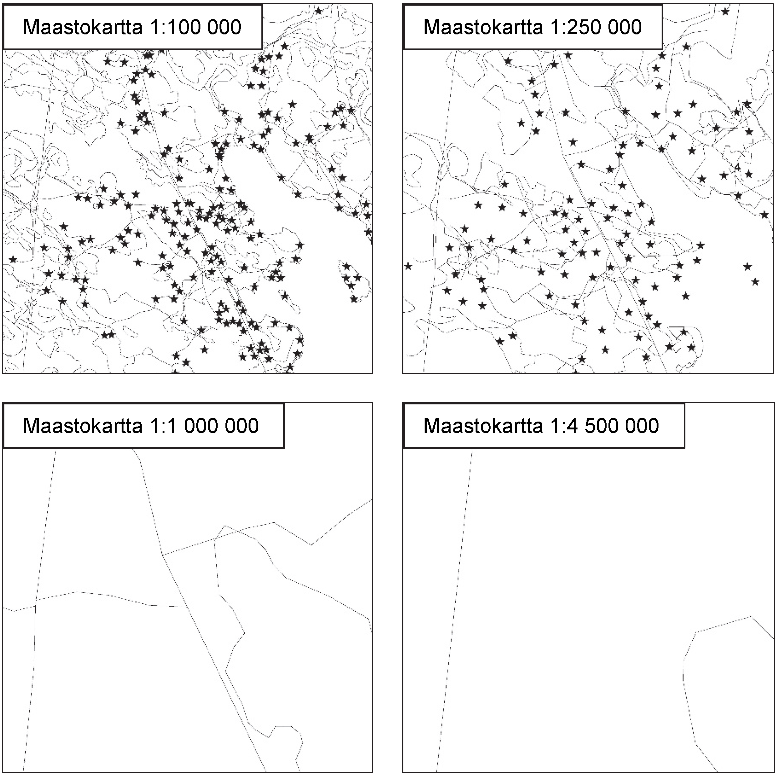
National Land Survey's Topographic map series in vector format is a dataset depicting the terrain of all of Finland. The most important elements are the road network, administrative borders, preservation areas, population centres, geographic names, waterways, land use and elevation. The largest scale level (1:100,000) of the Topographic map series in vector format is produced by generalising from the Topographic database. Topographic map series 1:250,000 is produced by generalising the dataset 1:100,000. Topographic map series 1:1,000,000 is produced by generalising the dataset 1:250,000. Topographic map series 1:4,500,000 is produced by generalising the dataset 1:1,000,000. The geographic names have been generalised from the geographic names in the Geographic Names Register to map names suited to the scale in question. The administrative borders in the Municipal Division of each scale are used as administrative borders. The Topographic map series in vector format can be used for the production of other map products, e.g. approach maps or maps on a regional or national level The product belongs to the open data of the National Land Survey of Finland. More information: Topographic data and how to acquire it http://www.maanmittauslaitos.fi/en/maps-and-spatial-data/expert-users/topographic-data-and-how-acquire-it.
-

The 1:100 000 scale bedrock map data of the Geological Survey of Finland (GTK) include material produced during 1948-2007 for the needs of the mapping of mineral resources, for the sustainable exploitation of aggregate resources and for scientific research. These data include lithological information as polygons, bedrock observation points and drilling sites as well as essential tectonic observations, and information on lithological primary structures, ore minerals and metamorphic index minerals. Some 1:100 000 map sheets give both stratigraphical information as well as lithological data. An explanatory text accompanies most map sheets.
-
The EMODnet (European Marine Observation and Data network) Geology project (http://www.emodnet-geology.eu/) collects and harmonizes marine geological data from the European sea areas to support decisionmaking and sustainable marine spatial planning. The partnership includes 39 marine organizations from 30 countries. The partners, mainly from the marine departments of the geological surveys of Europe (through the Association of European Geological Surveys- EuroGeoSurveys), have assembled marine geological information at a scale of 1:100 000 from all European sea areas (e.g. the White Sea, Baltic Sea, Barents Sea, the Iberian Coast, and the Mediterranean Sea within EU waters). This data includes the EMODnet seabed substrate map at a scale of 1:100 000 from the European marine areas. Traditionally, European countries have conducted their marine geological surveys according to their own national standards and classified substrates on the grounds of their national classification schemes. These national classifications are harmonized into a shared EMODnet schema using Folk's sediment triangle with a hierarchy of 16, 7 and 5 substrate classes. The data describes the seabed substrate from the uppermost 30 cm of the sediment column. The data has been generalized into a target scale (1:100 000). The smallest cartographic unit within the data is 0.05 km2 (5 hectares). Further information about the EMODnet-Geology project is available on the portal (http://www.emodnet-geology.eu/).
-

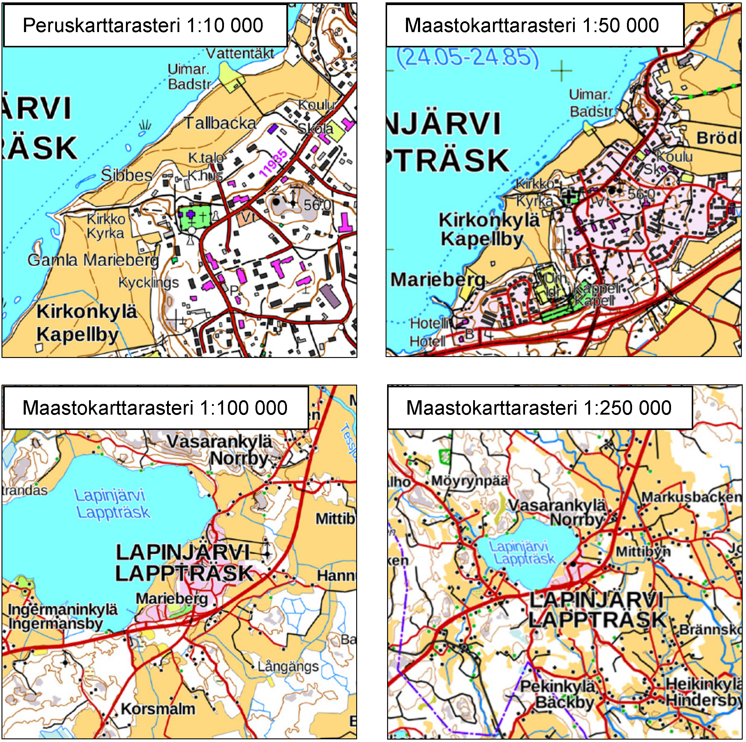
The Topographic map series is a dataset depicting the terrain of all of Finland. The key elements in it are the road network, buildings and constructions, geographic names, waterways, land use and elevation. The more precise levels of the Topographic map series consist of the same map objects and map symbols depicted in the same way as in the familiar Basic map. Basic map raster is applicable to be used, for instance, as a base map for planning land use or for excursion and outdoor recreational purposes in mobile devices and in various Internet services associated with nature. When going over to the more general datasets in the Topographic map series, the number and visualisation of objects and map symbols changes. The generalised small-scale Topographic maps raster are applicable to be used as approach maps in e.g. mobile devices and Internet services. The product belongs to the open data of the National Land Survey of Finland. More information: Topographic data and how to acquire it http://www.maanmittauslaitos.fi/en/maps-and-spatial-data/expert-users/topographic-data-and-how-acquire-it
-
Paavo - Open data by postal code area contain the following geographic data: 1) Paavo postal code areas 2) Paavo postal code areas (extended to sea areas) 3) Paavo statistical data (103 variables) combined with the postal code areas There are two different versions of the map data: extending to sea areas mainly produced for statistics production, and the version produced from this for map visualisation cut with the coastline. The map data contain the surface areas of the postal code areas and the municipality codes defined for the postal code areas. The statistical data contain data on the population structure, the degree of education, the income of the inhabitants and households, the size of house-holds and life stage, buildings and dwellings, workplaces, and the main ac-tivities of the inhabitants. The statistical data are also available in the PxWeb database (http://pxnet2.stat.fi/PXWeb/pxweb/en/Postinumeroalueittainen_avoin_tieto/). The data are protected. Protected data are indicated with -1. New data are updated annually in January. The data descriptions can be found in this link: http://tilastokeskus.fi/tup/paavo/paavon_aineistokuvaukset_en.html. The general Terms of Use must be observed when using the data: http://tilastokeskus.fi/org/lainsaadanto/copyright_en.html.
-

Municipal Division is a dataset depicting the municipal division in the whole of Finland. The Municipal Division dataset is produced in scales 1:10,000, 1:100,000, 1:250,000, 1:1,000,000 and 1:4,500,000. The data included in the dataset in scale 1:10,000 are taken from the cadastral registry. Regarding other scales, municipal boundaries have been generalised to suit the scale in question. The Municipal Division dataset is available as products both in vector and raster format. The products in vector format contain the number codes of the municipalities, the names of the municipalities in both Finnish and in Swedish as well as municipal boundaries and municipal geographical areas. In addition, the vector product includes the corresponding information about the regions, the State Administrative Agencies and the nation as well as a specification of the municipality's area into land and water area in MapInfo and Shape format. Products in raster format include municipal boundaries only. The product belongs to the open data of the National Land Survey of Finland. More information: Topographic data and how to acquire it http://www.maanmittauslaitos.fi/en/maps-and-spatial-data/expert-users/topographic-data-and-how-acquire-it .
-
Seabed substrate 1:100 000 is one of the products produced in the EMODnet (European Marine Observation and Data network) Geology III EU project. Project provided seabed geological material from the European maritime areas. The EMODnet Geology III project (http://www.emodnet-geology.eu/) collects and harmonizes geological data from the European sea areas to support decision-making and sustainable marine spatial planning. The EMODnet Geology partnership has included 39 marine organizations from 30 countries. This data includes the EMODnet seabed substrate map at a scale of 1:100 000 from the Finnish marine areas. It is based on the data produced on a scale of 1:20 000 by the Geological Survey of Finland (GTK). The data has been harmonized and reclassified into five Folk substrate classes (clay + silt (mud), sandy clays, clayey sands, coarse sediments, mixed sediments) and bedrock. The data describes the seabed substrate from the uppermost 30 cm of the sediment column. The data have been generalized into a target scale (1:100 000). The smallest smallest cartographic unit within the data is 0.05 km2 (5 hectares). Further information about the EMODnet-Geology project III is available on the portal (http://www.emodnet-geology.eu/). Permission (AN17367) to publish the material was obtained from the Finnish Defence Office 29.9.2017.
-
Osia Rovaniemen seutukunnan aluetta (Rovaniemi ja Ranua), vaihemaakuntakaava on maankäyttö- ja rakennuslain mukainen juridinen kaava jonka on laatinut Lapin liitto ja ympäristöministeriö vahvistanut 26.5.2010.
-
Pohjanmaan maakuntakaavayhdistelmä kattaa Pohjanmaan maakunnan alueella voimassa olevat maakuntakaavat: Pohjanmaan maakuntakaavan 2030 (vahvistettu Ympäristöministeriössä 21.12.2010), vaihemaakuntakaavan 1 (kaupalliset palvelut, vahvistettu 4.10.2013) ja vaihemaakuntakaavan 2 (uusiutuvat energiamuodot, vahvistettu 14.12.2015). Pohjanmaan liiton tuottama aineisto sisältää maankäytön aluevaraukset, johdot, kehittämisperiaatemerkinnät, kohteet, liikenteen, maisema-alueet, muinaismuistot, Natura-alueet, pintavedet, pohjavedet, suojelualueet, tuulivoiman ja virkistysreitit. HUOM! Karttataso "HAME Pohjanmaan maakuntakaavayhdistelmä" on HAME-hankkeessa (Harmonisoidut maakuntakaavat e-palveluiksi) julkaistu testipalvelu, jolle ei ole vielä omia metatietoja. Kyseessä on epävirallinen kaavayhdelmä. Metatiedot tulossa lähiaikoina.
-
Pirkanmaan hyvät ja yhtenäiset peltoalueet -selvitys tehtiin vuonna 2014 osana maakuntakaavan 2040 valmistelua. Selvityksessä määritellyt peltoalueet perustuvat pellon muodon ja koon tarkasteluihin. Lisäksi tarkasteltiin peltoalueiden salaojitustilannetta ja pintamaalajitietoa. Hyvien ja yhtenäisten peltoalueiden perusteena olivat vähintään 10 ha peltolohkot enintään 300 metrin etäisyydellä toisistaan ja peltolohkoista muodostuva vähintään 100 hehtaarin peltokokonaisuus. Selvityksen perusteella hyviä ja yhtenäisiä peltoalueita on Pirkanmaalla 203 ja ne vastaavat 76 % maakunnan kokonaispeltoalueesta. Aineisto soveltuu esimerkiksi yleispiirteisiin maankäytön suunnittelutehtäviin. Yksityiskohtaisia kysymyksiä ratkaistaessa on tarpeen hyödyntää ohessa tarkempia aineistoja.
 DEMO Paikkatietohakemisto