 DEMO Paikkatietohakemisto
1000
Type of resources
Available actions
Topics
Keywords
Contact for the resource
Provided by
Years
Formats
Representation types
Scale
Resolution
-

Grid net for statistics 1 km x 1 km covers whole of Finland. The grid net includes all grid squares in Finland. The location reference of a grid square is the coordinates of the bottom left corner of each grid cell. An identifier in accordance with national conventions (consecutive numbering) and INSPIRE definitions (format: 1kmNxxxxExxxx, where 1 km expresses the square grid size, N the y coordinate of the bottom left corner of the square divided by 1,000 and E the x coordinate of the bottom left corner of the square divided by 1,000) has been produced for each grid cell. The Grid net for statistics 1 km x 1 km is the area division used in the production of statistics by 1 km x 1 km squares. For utilizing grid data auxiliary tables of regional classifications are available: https://www.stat.fi/org/avoindata/paikkatietoaineistot/tilastoruudukko_1km_en.html. The general Terms of Use must be observed when using the data: http://tilastokeskus.fi/org/lainsaadanto/copyright_en.html.
-
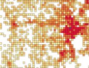
Number of population by 1 km x 1 km grids. The number of population on the last day of the reference year (31 December) by age group. Data includes only inhabited grids. The statistical variables of the data are: Total population (vaesto), number of men (miehet) and women (naiset), under 15 year olds (ika_0_14), 15-64 year olds (ika_15_64), and aged over 65 (ika_65_). Only the number of population is reported for grids of under 10 inhabitants. A grid identifier is expressed using a national identification code derived from the coordinates (idD_nro (num)) and INSPIRE's standard identification code (grd_id (char)). The data also contains the coordinates of the lower left-hand corner of a grid (xkoord, ykoord (num)). The data describes the population distribution independent of administrative areas (such as municipal borders). The data is suitable for examination of population distribution and making various spatial analysis. Data is available as polygons and as centroids of grid cells. The general Terms of Use must be observed when using the data: http://tilastokeskus.fi/org/lainsaadanto/copyright_en.html.
-

Road traffic accidents involving personal injury known to the police in Finland and reported to Statistics Finland, which have co-ordinate data. The data cover the following information: vvonn = year of the accident kkonn = month of the accident kello = time of the accident vakav = seriousness of the accident: 1 = accident resulting in death, 2 = accident resulting in injury, 3 = accident resulting in serious injury onntyyppi = type of accident: 0 = same direction of travel (going straight), 1 = same direction of travel (turning), 2 = opposite direction of travel (going straight), 3 = opposite direction of travel (turning), 4 = intersecting direction of travel (going straight), 5 = intersecting direction of travel (turning), 6 = pedestrian accident (on pedestrian crossing), 7 = pedestrian accident (elsewhere), 8 = running off the road, 9 = other accident lkmhapa = number of passenger cars and vans in the accident lkmlaka = number of buses and lorries in the accident lkmjk = number of pedestrians in the accident lkmpp = number of cyclists in the accident lkmmo = number of mopeds in the accident lkmmp = number of motor cycles in the accident lkmmuukulk = number of other vehicles in the accident x = x co-ordinate of the accident y = y co-ordinate of the accident The general Terms of Use must be observed when using the data: http://tilastokeskus.fi/org/lainsaadanto/copyright_en.html.
-
Number of population by 5 km x 5 km grids. The number of population on the last day of the reference year (31 December) by age group. Data includes only inhabited grids. The statistical variables of the data are: Total population (vaesto), number of men (miehet) and women (naiset), under 15 year olds (ika_0_14), 15–64 year olds (ika_15_64), and aged over 65 (ika_65_). Only the number of population is reported for grids of under 10 inhabitants. A grid identifier is expressed using a national identification code derived from the coordinates (idD_nro (num)) and INSPIRE's standard identification code (grd_id (char)). The data also contains the coordinates of the lower left-hand corner of a grid (xkoord, ykoord (num)). The data describes the population distribution independent of administrative areas (such as municipal borders). The data is suitable for examination of population distribution and making various spatial analysis. The general Terms of Use must be observed when using the data: http://tilastokeskus.fi/org/lainsaadanto/copyright_en.html.
-

-
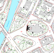
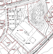
Yksityiskohtainen maastokartta eli kantakartta (1:500-1:2000) muodostaa pohja-aineiston rakentamiselle, kaavoitus- ja kiinteistömuodostustoiminnalle, kunnallisteknisille suunnitelmille, erilaisille yksityisille kartoille sekä opas- ja teemakartoille. Kantakartalla kuvattavia kohteita ovat kiinteistöt, rakennukset ja rakenteet, liikenneväylät, erilaiset maa- ja vesialueet, korkeustiedot, maanpäälliset johtotiedot, nimistö ja osoitteet. Aineisto on saatavissa myös WMS-palveluna.
-
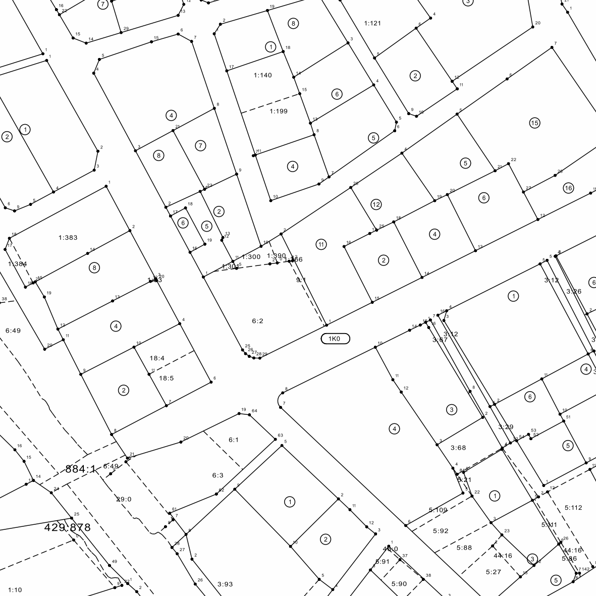
Jämsän kaupungin ylläpitämä kaavan pohjakartan kiinteistörajat. Kiinteistörajat kuvaa voimassa olevan kiinteistöjaotuksen. Aineistoa ylläpidetään jatkuvasti. Saatavissa WMS-palveluna sekä tiedostopalvelun kautta.
-
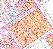
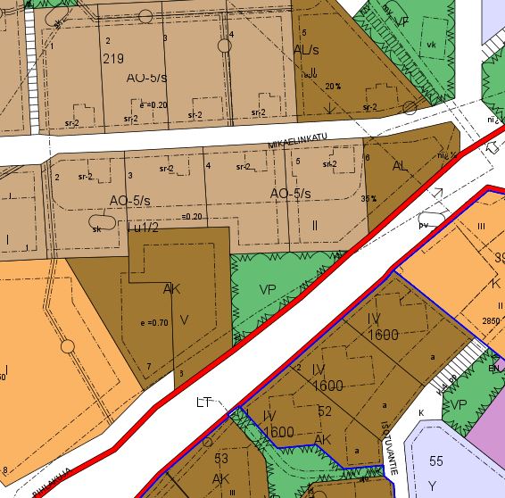
Asemakaavat ovat pohjakartalle piirrettyjä, maankäyttöä ohjaavia suunnitelmia. Asemakaavoissa osoitetaan yksityiskohtaisesti alueiden käyttötarkoitus kaavamääräyksineen ja -merkintöineen. Lainvoimaiset asemakaavat on yhdistetty yhdeksi aineistoksi, joka kuvaa kaavat kaavamääräyksineen koko Turun kaupungin alueelta. Aineisto on saatavissa WMS-palveluna.
-
Vihdin ylläpitämä sijaintitarkka kaavan pohjakartta-aineisto, maastoa, rakennettua ympäristöä ja kiinteistöjaotusta kuvaavia tietoja. Aineiston laajuus on n. 95 km2, joka on n. 16,5 % koko kunnan pinta-alasta. Aineisto on tuotettu osittain digitoimalla ja osittain ilmakuvausten ja maastomittausten kautta. Aineistoa päivitetään pääasiassa kaavoituksen tarpeiden mukaan. Rakennusten osalta päivitys on jatkuvaa ja perustuu sijaintikatselmuksiin. Tiestö päivitetään kolmen kuukauden kuluessa valmistumisesta. Aineisto sisältää kiinteistöt, rakennukset, liikenneväylät, vesistöt, korkeustiedot, maa- ja kasvipeitteen, nimistön sekä muut kohteet. Ylläpidossa tasokoordinaatistona on ETRS-GK24 (EPSG:3878), ja korkeusjärjestelmänä N2000 (EPSG:3900).
-
Aineisto on koostettu Laitilan, Kustavin, Pyhärannan, Taivassalon ja Vehmaan asemakaavoista. Sopiva tarkastelumittakaava vaihtelee alueittain.